
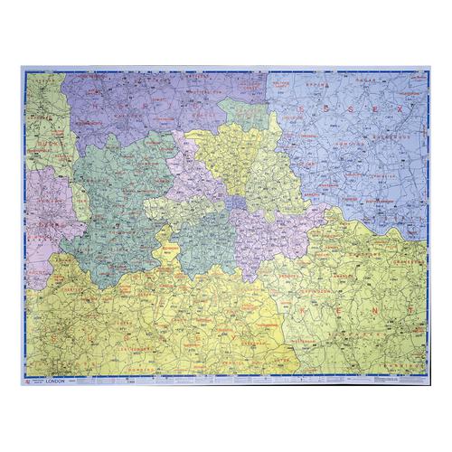
Map Marketing Postal Districts of London Map Unframed 1 Mile to 1 inch Scale W1180xH930mm Ref GLPC
Product Code: 053378
Consumer Delivery Expectation: Next working day
Category
Maps
Manufacturer Map Marketing
- Postcode maps are an essential resource to assist with business planning
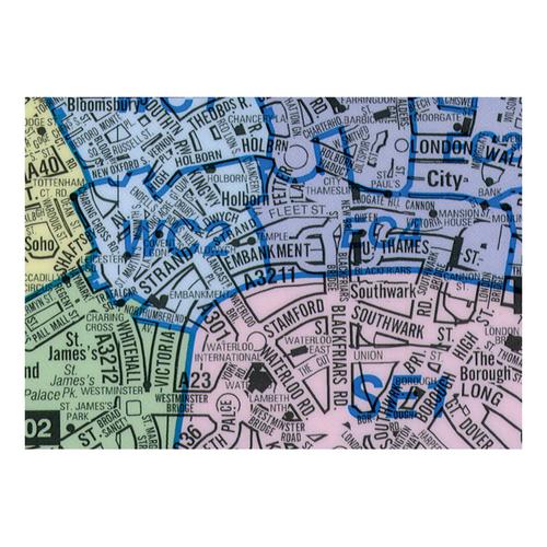
- Concentrates on highlighting the Postcode Districts (the first part of the Postcode or Outward Code) within Greater London. The roads are less highlighted to ensure that the Postcode information takes precedence
- Each Postcode area within Inner London is shown in a different colour for easy reference, Outer London is colour coded by County
- Main roads are numbered and named and underground and mainline train stations are shown along with major sporting venues
- The London Low Emission Zone and Congestion Zone boundaries are both shown on the map
- This map covers the following geographical area: North – London Colney South – Reigate East – Gravesend West – Beaconsfield
Description
Consumer Delivery Expectation: Next working day
Specifications
Lead Time
1
UNSPSC Code
55101501
Catalog Page Number
169
Brand
Map Marketing
Categories
Planners
Category
Maps
Dimensions
1180x930mm
Frame
Unframed
Laminated
Yes
Manufacturer
Map Marketing
Region
London Street Map
Scale
1: 64,221
Surface
Drywipe & Wetwipe
Type
Maps